Digital Map Backlash: Alternative Navigation Apps Surge in Popularity Following Controversial Geographic Renaming
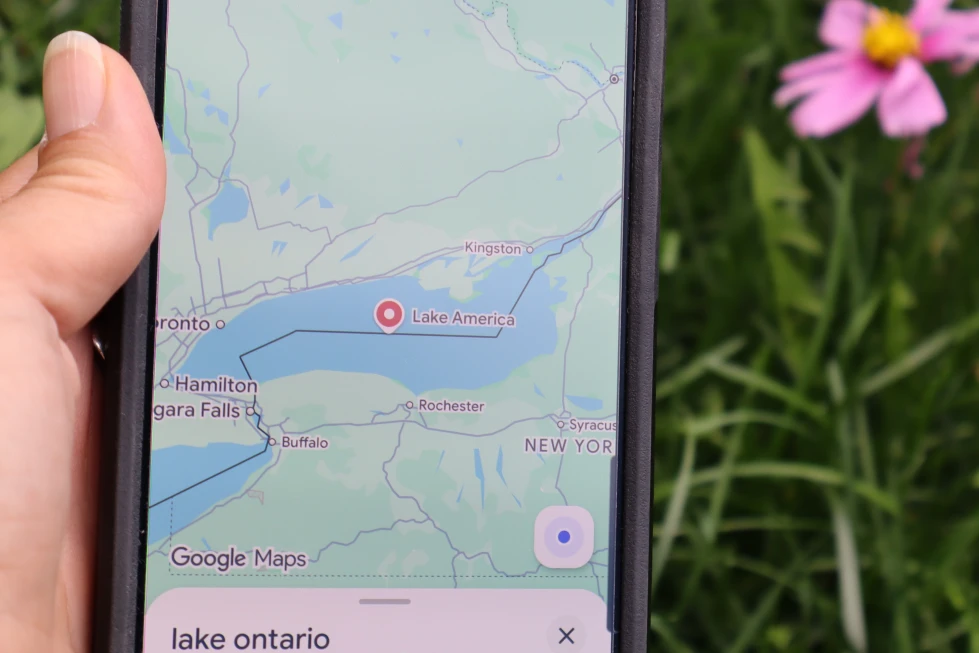
When major U.S. tech giants rapidly updated their digital maps to reflect a presidential executive order renaming a major North American lake, it sparked significant pushback among users. Coming on the heels of similar federal directives altering key body-of-water labels, the move has reignited ongoing concerns over Big Tech compliance and digital data privacy.
With one primary platform holding roughly 80% of the global mapping market share, many navigation users are actively searching for independent alternatives.
Here is a breakdown of the top privacy-focused and non-Big-Tech navigation solutions gaining traction right now:
1. Legacy Web Pioneers Making a Comeback
- Pioneering Navigation Services: Operating for three decades, one classic navigation platform experienced a massive resurgence in app store downloads across North America after publicly declining to adopt the updated presidential nomenclature. It offers turn-by-turn navigation, real-time traffic updates, and local amenity searches. While the mobile app remains region-specific to North America, its web platform is accessible globally as developers evaluate wider international availability.
- Dedicated Driving Navigation: A veteran European navigation pioneer—famous for popularizing early all-in-one GPS hardware—offers a clean, ad-free mobile app built specifically for drivers. It delivers real-time traffic alerts and road hazards without clutter, though it intentionally omits non-driving modes like walking or cycling transit.
2. Modern Feature-Rich Alternatives
- German Automotive Consortium Platform: Widely considered one of the most complete non-Big-Tech alternatives, this platform—backed by major European vehicle manufacturers—offers complete turn-by-turn routing across driving, public transit, walking, cycling, and taxi services. It supports multi-stop routes, customizable map layers (topographic, traffic, satellite), and full offline country map downloads without restrictive expiration dates.
- Note on Naming: Like major U.S. platforms, developers confirm that region-specific naming updates adhere to standardized national geographical database changes according to official governmental policy.
3. European Privacy-First Platforms (GDPR Compliant)
Unlike major platforms that monetized location tracking for targeted advertising, European-based map services operate under strict data protection frameworks, relying instead on enterprise licensing or freemium subscription models:
| App / Platform | Core Specialty | Key Features |
| Open-Source Maps | Community-Driven Data | Completely free, built on volunteer database mapping with seamless offline navigation. |
| Dutch Offline Tools | Strict Privacy Guarantees | Zero tracking or personal data collection; basic offline maps free with optional premium features. |
| GPS & Dashcam Tools | Driver Safety & Offline Use | Features speed camera alerts, traffic overlays, and integrated dashcam recording via subscription. |
| Outdoor Trail Planners | Hiking & Adventure | Famous for highly detailed offline topographical maps and trail navigation. |
4. Specialized Urban Transit Tools
- Public Transit Navigation: For city commuters looking to bypass driving altogether, dedicated urban travel tools offer multimodal journey planning across 430+ global cities, combining buses, subways, ferries, ride-shares, bikes, and scooters.
- Crowdsourced Traffic Alerts: While crowdsourced driver-alert platforms remain immensely popular for real-time hazard and speed-trap reporting, users should note that certain widely used apps in this category are subsidiary properties owned by major tech conglomerates.
💬 What’s Your Navigation Pick?
Are you sticking with default navigation apps, or have political name updates and privacy concerns made you consider switching to open-source or independent mapping platforms?